Category:WikiProject
FamilySearch Wiki:WikiProject England Parish Part 4
Pages in category "WikiProject"
The following 53 pages are in this category, out of 53 total.
F
W
- FamilySearch Wiki:WikiProject Adding Church Jurisdiction Maps to Country Church Records Pages
- FamilySearch Wiki:WikiProject Adding FS Collections to Brazil Municipalities Part 6
- FamilySearch Wiki:WikiProject Archive Holdings Extraction
- FamilySearch Wiki:WikiProject Colombia Municipality Pages in English Wiki
- FamilySearch Wiki:WikiProject Costa Rica Canton Pages in English Wiki
- FamilySearch Wiki:WikiProject El Salvador Municipality Pages in English Wiki
- FamilySearch Wiki:WikiProject Format Denmark Parish Place Names
- FamilySearch Wiki:WikiProject Honduras Municipality Pages in English Wiki
- FamilySearch Wiki:WikiProject How to create Dataverse projects
- FamilySearch Wiki:WikiProject Inserting Links into the MA Town Pages Task List
- FamilySearch Wiki:WikiProject Latin America Clickable Maps in English Wiki
- FamilySearch Wiki:WikiProject Latin America Clickable Maps in Spanish Wiki
- FamilySearch Wiki:WikiProject New Country Page Project
- FamilySearch Wiki:WikiProject New Parish Table for Parishes in Cornwall County
- FamilySearch Wiki:WikiProject New Parish Table for Parishes in Devon County
- FamilySearch Wiki:WikiProject New Parish Table for Parishes in Herefordshire County
- FamilySearch Wiki:WikiProject New Parish Table for Parishes in Nottinghamshire County
- FamilySearch Wiki:WikiProject New Parish Table for Parishes in Rutland County
- FamilySearch Wiki:WikiProject New Parish Table for Parishes in Staffordshire County
- FamilySearch Wiki:WikiProject New Parish Table for Parishes in Wiltshire County
- FamilySearch Wiki:WikiProject Switzerland Locality Histories/Geographies
- FamilySearch Wiki:WikiProject Update Denmark Parish Pages Part 2
- FamilySearch Wiki:WikiProject Update Denmark Parish Pages Part 3
- FamilySearch Wiki:WikiProject Updating England Parish Tables - Bristol Part 1
- FamilySearch Wiki:WikiProject Updating England Parish Tables - Bristol Part 4
- FamilySearch Wiki:WikiProject Venezuela Municipality Pages in English Wiki
- FamilySearch Wiki:WikiProject World Survey Archives and Libraries
- WikiProject: Massachusetts New Collections
- WikiProject: New Jersey, Alien Case Files, and Virginia New Collections
- WikiProject: North Dakota, South Dakota, and Kansas New Collections
- WikiProject: Uruguay, Peru, and Jamaica New Collections
- WikiProject:Add Funeral Homes and Obituaries Databases
- WikiProject:Adding Info to FHCs
- WikiProject:Adding Maryland Vital Records
- WikiProject:Alaska FSC Records
- WikiProject:Create Record Finder Pages
- WikiProject:Feast Day Calendars
- WikiProject:Gather Information from Wales Wiki Parish Pages
- WikiProject:Gathering Catalog Links
- WikiProject:Gathering US Catalog Links
- WikiProject:IRAD Database
- WikiProject:New England Infobox
- WikiProject:New Jersey FSC Records
- WikiProject:Update US State Native American pages
- WikiProject:US Death New Collections
- WikiProject:US Vital Records Pages
- WikiProject:World Conference 1980 Update
- WikiProjects:Probate Records for Massachusetts Towns
Media in category "WikiProject"
The following 134 files are in this category, out of 134 total.
 1 Cambridgeshire Parish List img.png 1,835 × 857; 149 KB
 1 Derbyshire .png 927 × 670; 72 KB
 1 Main Task List.png 1,997 × 978; 123 KB
 1 Old Main Page Multiple Tables.png 1,538 × 220; 45 KB
 2 A Main Task List Parish Page Embedded Links.png 430 × 281; 22 KB
 2 B Main Task Name.png 847 × 368; 41 KB
 2 Correct page of Parish List img.PNG 932 × 399; 43 KB
 3 A Parish Pages.png 1,303 × 608; 75 KB
 3 B Information from Parish Page to Task List.png 936 × 383; 43 KB
 3 Main Parish Page.PNG 1,118 × 821; 130 KB
 4 Parish Page to Task List.png 1,468 × 246; 27 KB
 4A Example of parish without NBI.png 1,701 × 814; 127 KB
 Add date and Notes to task list.PNG 1,320 × 179; 17 KB
 Atalaya Province, Ucayali Department, Peru Map.png 820 × 705; 201 KB
 Ayabaca Province, Piura Department, Peru Map.png 869 × 790; 244 KB
 Azángaro Province, Puno Department, Peru Map.png 546 × 873; 260 KB
 B3 Parish Pages.png 1,303 × 608; 76 KB
 Belmont Durham Table Code part 2.PNG 1,386 × 590; 68 KB
 Belmont Durham Table Code Tgen.PNG 1,649 × 243; 30 KB
 Belmont Durham Table Tgen.PNG 1,662 × 562; 79 KB
 Candarave Province, Tacna Department, Peru Map.png 621 × 910; 188 KB
 Carabaya Province, Puno Department, Peru Map.png 932 × 1,061; 334 KB
 Chucuito Province, Puno Department, Peru Map.png 609 × 907; 192 KB
 Completed Belmont Durham Table no Tgen.PNG 1,767 × 514; 84 KB
 Completed Section 2 of Table.PNG 999 × 362; 52 KB
 Contralmirante Villar Province, Tumbes Department, Peru Map.png 807 × 895; 189 KB
 Coronel Portillo Province, Ucayali Department, Peru Map.png 782 × 893; 199 KB
 Counties on Hold.png 2,524 × 179; 22 KB
 Daniel A. Carrión Province, Pasco Department, Peru Map.png 969 × 895; 321 KB
 Delete Marriage and Burial Lines.PNG 1,313 × 196; 25 KB
 Derbyshire Perish Pages.png 927 × 659; 74 KB
 El Collao Province, Puno Department, Peru Map.png 459 × 858; 161 KB
 England census section project 1.PNG 1,059 × 525; 185 KB
 Essex FMP Burial Index Years.PNG 1,723 × 651; 105 KB
 Essex FMP Index Years.PNG 1,709 × 755; 89 KB
 Finished Section1 of Table.PNG 1,134 × 109; 20 KB
 Finland Fix Subheadings.PNG 1,140 × 361; 20 KB
 FMP Code part 2.PNG 1,324 × 225; 25 KB
 FMP link on task list Part 2.PNG 937 × 469; 55 KB
 FMP location in Parish table.PNG 1,623 × 560; 91 KB
 General Sánchez Cerro Province, Moquegua Department, Peru Map.png 894 × 771; 261 KB
 Huancabamba Province, Piura Department, Peru Map.png 521 × 946; 214 KB
 Huancané Province, Puno Department, Peru Map.png 1,068 × 920; 278 KB
 Ia death edit source.png 895 × 172; 68 KB
 Ia marriage 3 code pasted.png 930 × 175; 114 KB
 Ilo Province, Moquegua Department, Peru Map.png 833 × 834; 147 KB
 Image 1 Talk Tab Updated 2.png 525 × 391; 119 KB
 Image 1 Talk Tab Updated.png 532 × 673; 226 KB
 Image 10 review history updated.png 1,598 × 834; 946 KB
 Image 12a edit source and revision prompt updated.png 1,608 × 732; 528 KB
 Image 13 updated.png 1,561 × 712; 453 KB
 Image 13a updated.png 1,608 × 521; 360 KB
 Image 14 No old parish table.JPG 682 × 283; 30 KB
 Image 15 new and old tables on talk page.JPG 1,763 × 834; 220 KB
 Image 2 Talk screen updated 2.jpg 1,034 × 529; 98 KB
 Image 2 Talk screen updated.jpg 1,034 × 529; 92 KB
 Image 3 Talk New Old Parish Table Updated 2.png 882 × 470; 231 KB
 Image 3 Talk New Old Parish Table Updated.png 893 × 715; 242 KB
 Image 4 Talk Tab Already Active.png 895 × 174; 84 KB
 Image 5 Talk Tab with old information.png 1,635 × 764; 725 KB
 Image 6 adding new old parish table to content.png 1,207 × 759; 592 KB
 Image 7 uncheck watch this page updated.png 741 × 416; 176 KB
 Image 8 page edit source updated.png 1,667 × 347; 231 KB
 Image 9 Talk New Parish Tab updated.png 1,357 × 375; 39 KB
 Italy Catalgo 2.png 1,230 × 809; 79 KB
 Italy Catalog 1.png 1,819 × 932; 190 KB
 Italy Catalog 4.PNG 952 × 748; 46 KB
 Italy Catalog 5.png 936 × 677; 50 KB
 Italy Catalog 6.png 990 × 557; 42 KB
 Italy Catalog 7.PNG 614 × 172; 19 KB
 Italy Catalog 8.PNG 813 × 153; 20 KB
 Italy Catalog 9.PNG 1,881 × 1,391; 164 KB
 Jorge Basadre Province, Tacna Department, Peru Map.png 858 × 845; 145 KB
 Lampa Province, Puno Department, Peru Map.png 744 × 797; 265 KB
 Main Page Cambridgeshire Parish Task List.png 1,835 × 857; 149 KB
 Main Task List Image 2.png 2,359 × 1,230; 93 KB
 Manu Province, Madre de Dios Department, Peru Map.png 1,021 × 849; 277 KB
 Map project pixel size.PNG 821 × 331; 33 KB
 Mariscal Nieto Province, Moquegua Department, Peru Map.png 856 × 709; 190 KB
 Melgar Province, Puno Department, Peru Map.png 631 × 981; 237 KB
 Moho Province, Puno Department, Peru Map.png 720 × 672; 168 KB
 Morropón Province, Piura Department, Peru Map.png 845 × 827; 282 KB
 Multiple Tables Image.png 1,691 × 582; 88 KB
 National Burial Index Main Page.png 1,904 × 871; 169 KB
 NBI 1 img 6 Update.png 1,037 × 815; 88 KB
 NBI code changes.png 850 × 668; 282 KB
 Notes Comments Examples.png 1,142 × 762; 140 KB
 Oxapampa Province, Pasco Department, Peru Map.png 1,006 × 870; 326 KB
 Padre Abad Province, Ucayali Department, Peru Map.png 621 × 741; 166 KB
 Parish Pages A3.png 1,250 × 666; 92 KB
 Part 2 County and Parish Task List.png 1,272 × 418; 54 KB
 Pasco Province, Pasco Department, Peru Map.png 1,329 × 945; 529 KB
 Piura Province, Piura Department, Peru Map.png 798 × 969; 257 KB
 Puno Province, Puno Department, Peru Map.png 772 × 947; 372 KB
 Purús Province, Ucayali Department, Peru Map.png 496 × 410; 53 KB
 Red links that work.png 824 × 330; 51 KB
 San Antonio de Putina Province, Puno Department, Peru Map.png 946 × 871; 248 KB
 San Román Province, Puno Department, Peru Map.png 1,236 × 888; 226 KB
 Sandia Province, Puno Department, Peru Map.png 596 × 1,049; 266 KB
 Sechura Province, Piura Department, Peru Map.png 883 × 846; 155 KB
 Show Preview Step.PNG 835 × 383; 43 KB
 Space between Section 2 of Table.PNG 919 × 244; 40 KB
 Step1 NBI Google Sheet.png 1,500 × 721; 91 KB
 Step1 NBI Side Project.png 1,500 × 792; 103 KB
 Step2 NBI Side Project.png 747 × 782; 106 KB
 Step3 Example of parish with NBI.png 1,052 × 460; 59 KB
 Step4 Parish without NBI and edit source.png 1,701 × 814; 135 KB
 Step5 Add NBI to list of websites.PNG 1,660 × 489; 68 KB
 Step5 edit source tab.png 920 × 268; 32 KB
 Step6 Add NBI to table.PNG 1,410 × 467; 50 KB
 Step7 No space between FMP and BOYD.PNG 1,063 × 63; 14 KB
 Step8 Space between FMP and BOYD.PNG 1,107 × 75; 22 KB
 Sullana Province, Piura Department, Peru Map.png 608 × 954; 217 KB
 Summary of Project.PNG 1,099 × 215; 17 KB
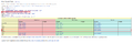 Table Example for no parish 7.png 1,756 × 567; 69 KB
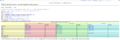 Table without NBI section.PNG 1,754 × 587; 70 KB
 Tacna Province, Tacna Department, Peru Map.png 1,355 × 920; 503 KB
 Tahuamanu Province, Madre de Dios Department, Peru Map.png 1,355 × 868; 263 KB
 Talara Province, Piura Department, Peru Map.png 617 × 899; 180 KB
 Tambopata Province, Madre de Dios Department, Peru Map.png 1,357 × 922; 373 KB
 Tarata Province, Tacna Department, Peru Map.png 1,005 × 857; 287 KB
 Task List Filled Out.png 1,966 × 607; 68 KB
 Tempsnip.png 1,220 × 192; 25 KB
 TGen example main page.png 1,568 × 726; 130 KB
 Tgen Parish Talk Page.PNG 708 × 534; 58 KB
 Tgen Project Task List.PNG 1,255 × 230; 41 KB
 Tumbes Province, Tumbes Department, Peru Map.png 546 × 845; 171 KB
 Under intro MI.PNG 1,403 × 351; 45 KB
 Updated FMP Essex Table Part 2.PNG 1,645 × 601; 90 KB
 US Catalog 5.png 1,729 × 418; 32 KB
 US Catalog 6.PNG 2,842 × 1,641; 398 KB
 Where to place NBI codes.png 1,052 × 460; 63 KB
 Yunguyo Province, Puno Department, Peru Map.png 971 × 598; 266 KB
 Zarumilla Province, Tumbes Department, Peru Map.png 398 × 830; 121 KB


