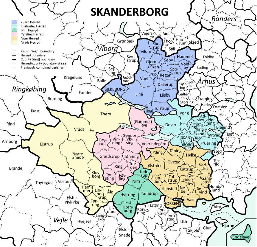
File:Skanderborg map.PNG
Size of this preview: 623 × 599 pixels. Other resolution: 888 × 854 pixels.
Original file (888 × 854 pixels, file size: 421 KB, MIME type: image/png)
Summary
| Description |
Skanderborg map |
|---|---|
| Author |
Kathryn Marshall |
| Source |
https://www.familysearch.org/wiki/en/File:Skanderborg_map.PNG |
| Date |
15 April 2020 |
| Permission |
see below |
Licensing
| This file is licensed under the Creative Commons Attribution-Share Alike 4.0 International license. | ||
|
File history
Click on a date/time to view the file as it appeared at that time.
| Date/Time | Thumbnail | Dimensions | User | Comment | |
|---|---|---|---|---|---|
| current | ★ Approved revision 17:28, 15 April 2020 | | 888 × 854 (421 KB) | Amberannelarsen (talk | contribs) | |
| 17:24, 15 April 2020 |  | 4,200 × 4,042 (1.84 MB) | Amberannelarsen (talk | contribs) | {{Information |Description = Skanderborg map |Source = https://www.familysearch.org/wiki/en/File:Skanderborg_map.PNG |Date = 15 April 2020 |Author = Kathryn Marshall |Permission = see below }} Category:Skanderborg County, Denmark |
You cannot overwrite this file.
File usage
The following 2 pages use this file: