MIME search
This page enables the filtering of files for their MIME type.
Input: contenttype/subtype or contenttype/*, e.g. image/jpeg.
Showing below up to 50 results in range #1 to #50.
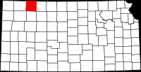
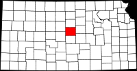
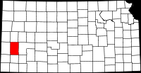
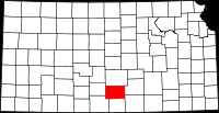
- (download) 200px-Map of Kansas highlighting Anderson County svg.bmp . . 200 × 103 . . 81 KB . . BingamanTD . . 12:03, 22 January 2013
- (download) 200px-Map of Kansas highlighting Atchison County svg.bmp . . 200 × 103 . . 81 KB . . BingamanTD . . 12:19, 22 January 2013
- (download) 200px-Map of Kansas highlighting Bourbon County svg.bmp . . 200 × 103 . . 81 KB . . StandingVE . . 13:22, 22 January 2013
- (download) 200px-Map of Kansas highlighting Brown County svg.bmp . . 200 × 103 . . 81 KB . . StandingVE . . 13:25, 22 January 2013
- (download) 200px-Map of Kansas highlighting Butler County svg.bmp . . 200 × 103 . . 81 KB . . StandingVE . . 13:31, 22 January 2013
- (download) 200px-Map of Kansas highlighting Chase County svg.bmp . . 200 × 103 . . 81 KB . . StandingVE . . 13:33, 22 January 2013
- (download) 200px-Map of Kansas highlighting Chautauqua County svg.bmp . . 200 × 103 . . 81 KB . . StandingVE . . 13:35, 22 January 2013
- (download) 200px-Map of Kansas highlighting Cherokee County svg.bmp . . 200 × 103 . . 81 KB . . StandingVE . . 13:37, 22 January 2013
- (download) 200px-Map of Kansas highlighting Cheyenne County svg.bmp . . 200 × 103 . . 81 KB . . StandingVE . . 13:39, 22 January 2013
- (download) 200px-Map of Kansas highlighting Clark County svg.bmp . . 200 × 103 . . 81 KB . . StandingVE . . 13:41, 22 January 2013
- (download) 200px-Map of Kansas highlighting Clay County svg.bmp . . 200 × 103 . . 81 KB . . StandingVE . . 13:43, 22 January 2013
- (download) 200px-Map of Kansas highlighting Cloud County svg.bmp . . 200 × 103 . . 81 KB . . StandingVE . . 13:46, 22 January 2013
- (download) 200px-Map of Kansas highlighting Coffey County svg.bmp . . 200 × 103 . . 81 KB . . StandingVE . . 13:48, 22 January 2013
- (download) 200px-Map of Kansas highlighting Comanche County svg.bmp . . 200 × 103 . . 81 KB . . StandingVE . . 13:50, 22 January 2013
- (download) 200px-Map of Kansas highlighting Cowley County svg.bmp . . 200 × 103 . . 81 KB . . BingamanTD . . 12:25, 22 January 2013
- (download) 200px-Map of Kansas highlighting Crawford County svg.bmp . . 200 × 103 . . 81 KB . . StandingVE . . 13:52, 22 January 2013
- (download) 200px-Map of Kansas highlighting Decatur County svg.bmp . . 200 × 103 . . 81 KB . . StandingVE . . 14:15, 22 January 2013
- (download) 200px-Map of Kansas highlighting Dickinson County svg.bmp . . 200 × 103 . . 81 KB . . StandingVE . . 14:20, 22 January 2013
- (download) 200px-Map of Kansas highlighting Doniphan County svg.bmp . . 200 × 103 . . 81 KB . . StandingVE . . 14:25, 22 January 2013
- (download) 200px-Map of Kansas highlighting Douglas County svg.bmp . . 200 × 103 . . 81 KB . . StandingVE . . 14:29, 22 January 2013
- (download) 200px-Map of Kansas highlighting Edwards County svg.bmp . . 200 × 103 . . 81 KB . . StandingVE . . 14:35, 22 January 2013
- (download) 200px-Map of Kansas highlighting Elk County svg.bmp . . 200 × 103 . . 81 KB . . StandingVE . . 14:39, 22 January 2013
- (download) 200px-Map of Kansas highlighting Ellis County svg.bmp . . 200 × 103 . . 81 KB . . StandingVE . . 15:13, 22 January 2013
- (download) 200px-Map of Kansas highlighting Ellsworth County svg.bmp . . 200 × 103 . . 81 KB . . StandingVE . . 15:20, 22 January 2013
- (download) 200px-Map of Kansas highlighting Finney County svg.bmp . . 200 × 103 . . 81 KB . . StandingVE . . 08:40, 23 January 2013
- (download) 200px-Map of Kansas highlighting Ford County svg.bmp . . 200 × 103 . . 81 KB . . StandingVE . . 08:45, 23 January 2013
- (download) 200px-Map of Kansas highlighting Franklin County svg.bmp . . 200 × 103 . . 81 KB . . StandingVE . . 08:49, 23 January 2013
- (download) 200px-Map of Kansas highlighting Geary County svg.bmp . . 200 × 103 . . 81 KB . . StandingVE . . 08:54, 23 January 2013
- (download) 200px-Map of Kansas highlighting Gove County svg.bmp . . 200 × 103 . . 81 KB . . StandingVE . . 09:27, 23 January 2013
- (download) 200px-Map of Kansas highlighting Graham County svg.bmp . . 200 × 103 . . 81 KB . . StandingVE . . 09:31, 23 January 2013
- (download) 200px-Map of Kansas highlighting Grant County svg.bmp . . 200 × 103 . . 81 KB . . StandingVE . . 09:38, 23 January 2013
- (download) 200px-Map of Kansas highlighting Gray County svg.bmp . . 200 × 103 . . 81 KB . . StandingVE . . 09:43, 23 January 2013
- (download) 200px-Map of Kansas highlighting Greeley County svg.bmp . . 200 × 103 . . 81 KB . . StandingVE . . 09:55, 23 January 2013
- (download) 200px-Map of Kansas highlighting Greenwood County svg.bmp . . 200 × 103 . . 81 KB . . StandingVE . . 11:19, 23 January 2013
- (download) 200px-Map of Kansas highlighting Hamilton County svg.bmp . . 200 × 103 . . 81 KB . . StandingVE . . 11:24, 23 January 2013
- (download) 200px-Map of Kansas highlighting Harper County svg.bmp . . 200 × 103 . . 81 KB . . StandingVE . . 11:30, 23 January 2013
- (download) 200px-Map of Kansas highlighting Harvey County svg.bmp . . 200 × 103 . . 81 KB . . StandingVE . . 11:36, 23 January 2013
- (download) 200px-Map of Kansas highlighting Haskell County svg.bmp . . 200 × 103 . . 81 KB . . StandingVE . . 11:56, 23 January 2013
- (download) 200px-Map of Kansas highlighting Hodgeman County svg.bmp . . 200 × 103 . . 81 KB . . StandingVE . . 12:03, 23 January 2013
- (download) 200px-Map of Kansas highlighting Jackson County svg.bmp . . 200 × 103 . . 81 KB . . StandingVE . . 12:11, 23 January 2013
- (download) 200px-Map of Kansas highlighting Jefferson County svg.bmp . . 200 × 103 . . 81 KB . . StandingVE . . 12:16, 23 January 2013
- (download) 200px-Map of Kansas highlighting Jewell County svg.bmp . . 200 × 103 . . 81 KB . . StandingVE . . 08:05, 24 January 2013
- (download) 200px-Map of Kansas highlighting Johnson County svg.bmp . . 200 × 103 . . 81 KB . . StandingVE . . 08:37, 24 January 2013
- (download) 200px-Map of Kansas highlighting Kearny County svg.bmp . . 200 × 103 . . 81 KB . . StandingVE . . 10:28, 24 January 2013
- (download) 200px-Map of Kansas highlighting Kingman County svg.bmp . . 200 × 103 . . 81 KB . . StandingVE . . 10:48, 24 January 2013
- (download) 200px-Map of Kansas highlighting Kiowa County svg.bmp . . 200 × 103 . . 81 KB . . StandingVE . . 11:09, 24 January 2013
- (download) 200px-Map of Kansas highlighting Labette County svg.bmp . . 200 × 103 . . 81 KB . . StandingVE . . 11:14, 24 January 2013
- (download) 200px-Map of Kansas highlighting Lane County svg.bmp . . 200 × 103 . . 81 KB . . StandingVE . . 06:45, 29 January 2013
- (download) 200px-Map of Kansas highlighting Leavenworth County svg.bmp . . 200 × 103 . . 81 KB . . StandingVE . . 06:50, 29 January 2013
- (download) 200px-Map of Kansas highlighting Lincoln County svg.bmp . . 200 × 103 . . 81 KB . . StandingVE . . 06:55, 29 January 2013