File:Tempio Pausania Locator Map.PNG
No higher resolution available.
Tempio_Pausania_Locator_Map.PNG (247 × 444 pixels, file size: 33 KB, MIME type: image/png)
Summary[edit | edit source]
| Description |
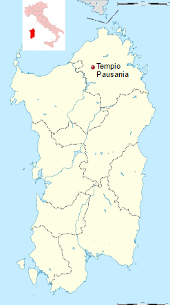
Tempio Pausania Locator Map | ||
|---|---|---|---|
| Author | |||
| Source |
File:Italy provincial location map 2016.svg; Tempio Pausania | ||
| Date |
2 April 2016 | ||
| Permission |
This file is licensed under the Creative Commons Attribution-Share Alike 3.0 Unportedlicense.
You are free:
Under the following conditions:
Diese Datei wurde unter der Creative Commons Attribution-Share Alike 3.0 Unported (Namensnennung-Weitergabe unter gleichen Bedingungen 3.0 Unported) lizenziert.
Es ist Ihnen gestattet,
sofern Sie folgende Bedingungen einhalten:
|

File history
Click on a date/time to view the file as it appeared at that time.
| Date/Time | Thumbnail | Dimensions | User | Comment | |
|---|---|---|---|---|---|
| current | ★ Approved revision 09:16, 11 October 2016 | | 247 × 444 (33 KB) | Katieliston (talk | contribs) | {{Information |Description =Tempio Pausania Locator Map |Source =https://en.wikipedia.org/wiki/Tempio_Pausania |Date = See Metadata below |Author = See Metadata below |Permission = }} |
You cannot overwrite this file.
File usage
There are no pages that use this file.