File:Montefranco Locator Map.PNG
No higher resolution available.
Montefranco_Locator_Map.PNG (242 × 311 pixels, file size: 31 KB, MIME type: image/png)
Summary[edit | edit source]
| Description |
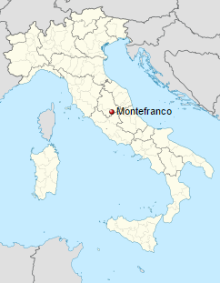
Montefranco Locator Map | ||
|---|---|---|---|
| Author | |||
| Source | |||
| Date |
2 April 2016 | ||
| Permission |
|

File history
Click on a date/time to view the file as it appeared at that time.
| Date/Time | Thumbnail | Dimensions | User | Comment | |
|---|---|---|---|---|---|
| current | ★ Approved revision 15:36, 17 October 2016 | | 242 × 311 (31 KB) | Katieliston (talk | contribs) | {{Information |Description =Montefranco_Locator_Map |Source =https://en.wikipedia.org/wiki/Montefranco |Date = See Metadata below |Author = See Metadata below |Permission = }} |
You cannot overwrite this file.
File usage
There are no pages that use this file.