File:Mohawk Trail map.png
Original file (959 × 579 pixels, file size: 293 KB, MIME type: image/png)
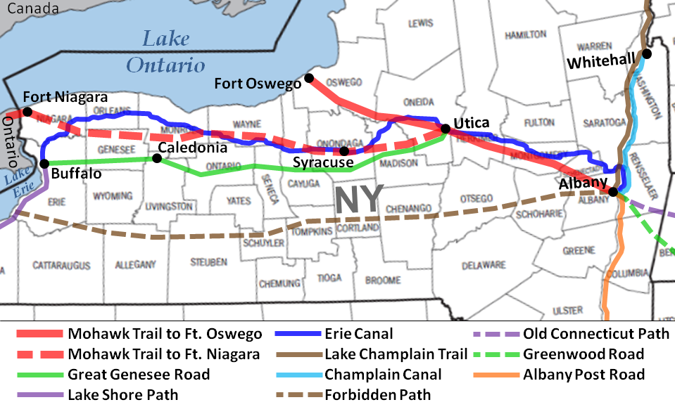
Description: Map of the Mohawk or Iroquois Trail to Fort Oswego and Fort Niagara, New York and connected migration pathways.
Drawn by: Diltsgd (FamilySearch Research Wiki).
Date: 1 July 2011.
Source: Based on the route descriptions given in Handybook for Genealogists: United States of America, 10th ed. (Draper, Utah: Everton Pub., 2002), 847-54. WorldCat entry. FS Library Book 973 D27e 2002.
Permission: Public domain. I, Diltsgd (FamilySearch Research Wiki), the copyright holder of this work, hereby release it into the public domain. This applies worldwide. In case this is not legally possible: I grant anyone the right to use this work for any purpose, without any conditions, unless such conditions are required by law.
File history
Click on a date/time to view the file as it appeared at that time.
| Date/Time | Thumbnail | Dimensions | User | Comment | |
|---|---|---|---|---|---|
| current | ★ Approved revision 12:16, 5 July 2011 | | 959 × 579 (293 KB) | DiltsGD (talk | contribs) | |
| 08:49, 1 July 2011 |  | 960 × 577 (293 KB) | DiltsGD (talk | contribs) | ||
| 08:36, 1 July 2011 |  | 959 × 549 (295 KB) | DiltsGD (talk | contribs) | '''Description:''' Map of the Mohawk or Iroquois Trail to Fort Oswego and Fort Niagara, New York and connected migration pathways. <br> '''Drawn by:''' Diltsgd (FamilySearch Research Wiki). <br> '''Date:''' 1 July 2011. <br> '''Source:''' |
You cannot overwrite this file.
File usage
The following 4 pages use this file: