File:SC Migration Trails.png
Original file (907 × 720 pixels, file size: 706 KB, MIME type: image/png)
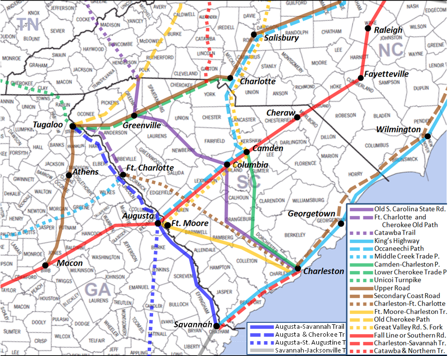
Description: Colonial South Carolina Migration Trails Map.
Drawn by: User:DiltsGD (FamilySearch Wiki user)
Date: 22 January 2011.
Source: Self drawn map. Information about routes provided mostly by Handybook for Genealogists, 10th ed.
Permission: Public domain. I, DiltsGD, the copyright holder of this work, hereby release it into the public domain. This applies worldwide. In case this is not legally possible: I grant anyone the right to use this work for any purpose, without any conditions, unless such conditions are required by law.
File history
Click on a date/time to view the file as it appeared at that time.
| Date/Time | Thumbnail | Dimensions | User | Comment | |
|---|---|---|---|---|---|
| current | ★ Approved revision 19:53, 25 March 2011 | | 907 × 720 (706 KB) | DiltsGD (talk | contribs) | |
| 19:45, 25 March 2011 |  | 960 × 720 (735 KB) | DiltsGD (talk | contribs) | ||
| 15:27, 22 January 2011 |  | 1,211 × 964 (949 KB) | DiltsGD (talk | contribs) | '''Description:''' Colonial South Carolina Migration Trails Map.<br> '''Drawn by:''' User:DiltsGD (FamilySearch Wiki user)<br> '''Date:''' 22 January 2011.<br> '''Source:''' Self drawn map. Information about routes provided mostly by ''Handybook for G |
You cannot overwrite this file.
File usage
The following 6 pages use this file: