File:Micronesia Area Map.PNG
Micronesia_Area_Map.PNG (500 × 500 pixels, file size: 10 KB, MIME type: image/png)
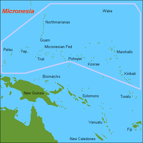
Description: Map of the Pacific Ocean Countries in Micronesia area including Guam, Kiribati, Marshall Islands, Nauru, Northern Mariana Islands, Palau, and the Federated States of Countries in Micronesia.
Author: Wikipedia's Hobe, 2007-07-01.
Source: WikiMeda Commons at http://upload.wikimedia.org/wikipedia/commons/c/cd/Map_OC-Countries in Micronesia.PNG
License: Public domain I, Hobe, the copyright holder of this work, hereby release it into the public domain. This applies worldwide. In case this is not legally possible, I grant anyone the right to use this work for any purpose, without any conditions, unless such conditions are required by law.
...]
File history
Click on a date/time to view the file as it appeared at that time.
| Date/Time | Thumbnail | Dimensions | User | Comment | |
|---|---|---|---|---|---|
| current | ★ Approved revision 15:50, 16 August 2008 | | 500 × 500 (10 KB) | DiltsGD (talk | contribs) | '''Description:''' Map of the Pacific Ocean Micronesia area including Guam, Kiribati, Marshall Islands, Nauru, Northern Mariana Islands, Palau, and the Federated States of Micronesia. '''Author:''' Wikipedia's Hobe, 2007-07-01. '''Source:''' WikiMeda Co |
You cannot overwrite this file.
File usage
The following page uses this file: