File:Wisconsinterritory.PNG
No higher resolution available.
Wisconsinterritory.PNG (565 × 432 pixels, file size: 62 KB, MIME type: image/png)
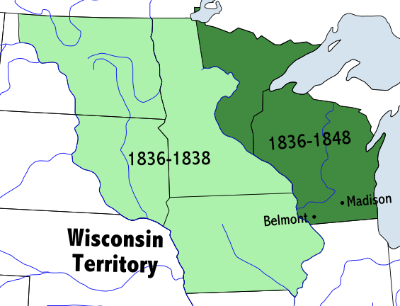
Map of the Wisconsin Territory 1836 - 1848
Permission is granted to copy, distribute and/or modify this document under the terms of the GNU Free Documentation License, Version 1.2 or any later version published by the Free Software Foundation; with no Invariant Sections, no Front-Cover Texts, and no Back-Cover Texts. A copy of the license is included in the section entitled "GNU Free Documentation License". Copied from Wikimedia Commons.
File history
Click on a date/time to view the file as it appeared at that time.
| Date/Time | Thumbnail | Dimensions | User | Comment | |
|---|---|---|---|---|---|
| current | ★ Approved revision 10:07, 14 March 2009 | | 565 × 432 (62 KB) | Familyjournals (talk | contribs) | Map of the Wisconsin Territory 1836 - 1848 |
You cannot overwrite this file.
File usage
The following page uses this file: