Template:VA Radford: Difference between revisions
(Template, Clickable Boundry Map) |
Brepouille (talk | contribs) m (Added Category per WA) |
||
| (One intermediate revision by one other user not shown) | |||
| Line 3: | Line 3: | ||
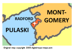
poly 7 90 111 33 128 59 146 47 161 61 133 66 144 76 118 96 137 113 143 164 121 181 40 180 8 140 8 140 [[Pulaski County, Virginia Genealogy|Pulaski County]] | poly 7 90 111 33 128 59 146 47 161 61 133 66 144 76 118 96 137 113 143 164 121 181 40 180 8 140 8 140 [[Pulaski County, Virginia Genealogy|Pulaski County]] | ||
#<!-- Created by Online Image Map Editor (http://www.maschek.hu/imagemap/index) --> | #<!-- Created by Online Image Map Editor (http://www.maschek.hu/imagemap/index) --> | ||
desc none | |||
</imagemap> | </imagemap> | ||
<noinclude>[[Category:Image map templates]]</noinclude> | <noinclude>[[Category:Image map templates]][[Category:VA Image map templates]][[Category:Templates for places]]</noinclude> | ||
Latest revision as of 15:35, 8 July 2020