Template:VA Lexington: Difference between revisions
(Template, Clickable Boundry Map) |
Brepouille (talk | contribs) m (Added Category per WA) |
||
| (One intermediate revision by one other user not shown) | |||
| Line 4: | Line 4: | ||
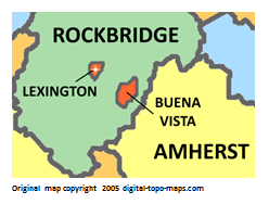
poly 238 97 206 85 209 61 179 48 173 69 160 50 136 57 135 97 93 137 89 152 69 161 232 163 232 163 [[Amherst County, Virginia Genealogy|Amherst County]] | poly 238 97 206 85 209 61 179 48 173 69 160 50 136 57 135 97 93 137 89 152 69 161 232 163 232 163 [[Amherst County, Virginia Genealogy|Amherst County]] | ||
#<!-- Created by Online Image Map Editor (http://www.maschek.hu/imagemap/index) --> | #<!-- Created by Online Image Map Editor (http://www.maschek.hu/imagemap/index) --> | ||
desc none | |||
</imagemap> | </imagemap> | ||
<noinclude>[[Category:Image map templates]]</noinclude> | <noinclude>[[Category:Image map templates]][[Category:VA Image map templates]][[Category:Templates for places]]</noinclude> | ||
Latest revision as of 15:20, 8 July 2020