Template:MO Jackson County: Difference between revisions
m (Text replacement - "--> </imagemap>" to "--> desc none </imagemap>") |
Bethcottam (talk | contribs) (clickable boundary map) |
||
| Line 9: | Line 9: | ||
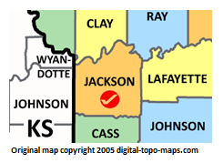
poly 46 42 25 37 29 76 39 69 47 73 78 78 84 65 74 55 64 58 54 57 45 37 [[Wyandotte County, Kansas Genealogy|Wyandotte County]] | poly 46 42 25 37 29 76 39 69 47 73 78 78 84 65 74 55 64 58 54 57 45 37 [[Wyandotte County, Kansas Genealogy|Wyandotte County]] | ||
#<!-- Created by Online Image Map Editor (http://www.maschek.hu/imagemap/index) --> | #<!-- Created by Online Image Map Editor (http://www.maschek.hu/imagemap/index) --> | ||
</imagemap><noinclude>[[Category:Image map templates]]</noinclude> | </imagemap><noinclude>[[Category:Image map templates]]</noinclude> | ||
Revision as of 17:30, 28 November 2018