Template:UT Davis County: Difference between revisions
m (Text replacement - "--> </imagemap>" to "--> desc none </imagemap>") |
Bethcottam (talk | contribs) (clickable boundary map) |
||
| Line 6: | Line 6: | ||
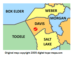
poly 13 165 118 159 106 112 85 66 46 85 8 74 12 161 [[Tooele County, Utah Genealogy|Tooele County]] | poly 13 165 118 159 106 112 85 66 46 85 8 74 12 161 [[Tooele County, Utah Genealogy|Tooele County]] | ||
#<!-- Created by Online Image Map Editor (http://www.maschek.hu/imagemap/index) --> | #<!-- Created by Online Image Map Editor (http://www.maschek.hu/imagemap/index) --> | ||
</imagemap><noinclude>[[Category:Image map templates]]</noinclude> | </imagemap><noinclude>[[Category:Image map templates]]</noinclude> | ||
Revision as of 10:25, 31 August 2018