Template:IL Pulaski County: Difference between revisions
m (Text replacement - "--> </imagemap>" to "--> desc none </imagemap>") |
Bethcottam (talk | contribs) (clickable boundary map) |
||
| Line 7: | Line 7: | ||
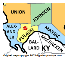
poly 213 152 210 180 146 180 123 99 217 154 [[McCracken County, Kentucky Genealogy|McCracken County]] | poly 213 152 210 180 146 180 123 99 217 154 [[McCracken County, Kentucky Genealogy|McCracken County]] | ||
#<!-- Created by Online Image Map Editor (http://www.maschek.hu/imagemap/index) --> | #<!-- Created by Online Image Map Editor (http://www.maschek.hu/imagemap/index) --> | ||
</imagemap><noinclude>[[Category:Image map templates]]</noinclude> | </imagemap><noinclude>[[Category:Image map templates]]</noinclude> | ||
Revision as of 15:50, 3 August 2018