File:US Locator Map Illinois Tazewell.PNG: Difference between revisions
Katieliston (talk | contribs) (Locator map of Illinois Tazewell. Created by katieliston 8 July 2016.) |
Brycedespain (talk | contribs) No edit summary |
||
| Line 3: | Line 3: | ||
== Licensing == | == Licensing == | ||
{{cc-by-sa-3.0,2.5,2.0,1.0}} | {{cc-by-sa-3.0,2.5,2.0,1.0}} | ||
[[Category:Locator maps of Illinois]] | |||
Latest revision as of 11:38, 26 July 2018
Summary[edit | edit source]
Locator map of Illinois Tazewell. Created by katieliston 8 July 2016.
Licensing[edit | edit source]
| This file is licensed under the Creative Commons Attribution-Share Alike 3.0 Unported, 2.5 Generic, 2.0 Generic and 1.0 Generic license. | ||
|
File history
Click on a date/time to view the file as it appeared at that time.
| Date/Time | Thumbnail | Dimensions | User | Comment | |
|---|---|---|---|---|---|
| current | ★ Approved revision 12:47, 8 July 2016 | 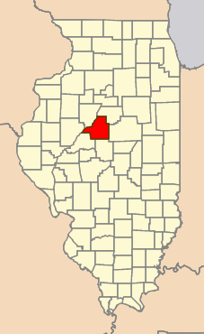 | 227 × 370 (18 KB) | Katieliston (talk | contribs) | Locator map of Illinois Tazewell. Created by katieliston 8 July 2016. |
You cannot overwrite this file.
File usage
The following page uses this file: