File:PEI map.png: Difference between revisions
m (Text replace - "Category:Prince_Edward_Island" to "Category:Prince Edward Island, Canada") |
mNo edit summary |
||
| Line 2: | Line 2: | ||
[[Category:Prince Edward Island, Canada]] | [[Category:Prince Edward Island, Canada]] | ||
[[Category:Locator maps of Prince Edward Island]] | |||
Revision as of 13:29, 25 July 2018
Description: Map of Prince Edward Island Province of Canada.
Drawn by: EOZyo (WikiMedia user).
Date: 29 September 2008(2008-09-29).
Source: "Prince Edward Island" in Wikipedia: the Free Encyclopedia at http://en.wikipedia.org/wiki/Prince_Edward_Island (25 October 2010).
Permission: Public domain. I, the copyright holder of this work, hereby release it into the public domain. This applies worldwide. In case this is not legally possible: I grant anyone the right to use this work for any purpose, without any conditions, unless such conditions are required by law.
File history
Click on a date/time to view the file as it appeared at that time.
| Date/Time | Thumbnail | Dimensions | User | Comment | |
|---|---|---|---|---|---|
| current | ★ Approved revision 09:03, 25 October 2010 | 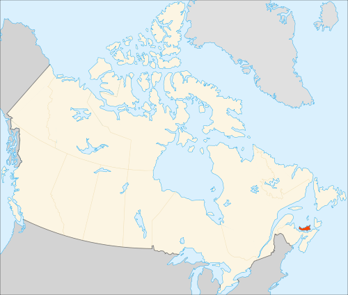 | 500 × 424 (86 KB) | DiltsGD (talk | contribs) | |
| 08:54, 25 October 2010 |  | 706 × 599 (136 KB) | DiltsGD (talk | contribs) | '''Description:''' Map of Prince Edward Island Province of Canada. <br> '''Drawn by:''' [http://en.wikipedia.org/wiki/User:EOZyo EOZyo] (WikiMedia user). <br> '''Date:''' 29 September 2008(2008-09-29). <br> '''Source:''' "Prince Edward Island" in ''Wikipe |
You cannot overwrite this file.
File usage
The following 8 pages use this file:
- Canada, Prince Edward Island Baptism Card Index - FamilySearch Historical Records
- Canada, Prince Edward Island Census, 1861 - FamilySearch Historical Records
- Canada, Prince Edward Island Church Records - FamilySearch Historical Records
- Canada, Prince Edward Island Death Card Index - FamilySearch Historical Records
- Canada, Prince Edward Island Marriage Registers - FamilySearch Historical Records
- Prince Edward Island, Canada Genealogy
- User:Batsondl/Sandbox 73
- User:Evancol/Sandbox/Prince