File:SD PERKINS.JPG: Difference between revisions
m (add license info) |
(Amberannelarsen uploaded a new version of File:SD PERKINS.JPG) |
(No difference)
| |
Latest revision as of 12:57, 28 December 2017
Summary[edit | edit source]
Map courtesy of Digital-Topo-Maps.com. Copyright 2005.
Licensing[edit | edit source]
 |
This image is under copyright by the owner, Digital-Topo-Maps and is used by permission under the condition that the copyright is listed and attribution is given. This work is not subject to any Creative Commons license. |
File history
Click on a date/time to view the file as it appeared at that time.
| Date/Time | Thumbnail | Dimensions | User | Comment | |
|---|---|---|---|---|---|
| current | ★ Approved revision 12:57, 28 December 2017 |  | 383 × 392 (28 KB) | Amberannelarsen (talk | contribs) | |
| 06:44, 14 October 2017 |  | 415 × 434 (33 KB) | Djheaven (talk | contribs) | Map courtesy of [https://www.digital-topo-maps.com/county-map/kansas.shtml/ Digital-Topo-Maps.com]. Copyright 2005.<br> Category:South Dakota Maps<br> Category: Perkins County, South Dakota<br> | |
| 08:06, 15 May 2015 | 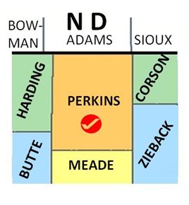 | 268 × 290 (20 KB) | Claudiaj64 (talk | contribs) | Category:Perkins County, South Dakota Category: South Dakota _Maps |
You cannot overwrite this file.
File usage
There are no pages that use this file.