Template:MOGreene, Missouri Clickable Neighbors: Difference between revisions
m (Added map attributes; removed blank lines) |
Karenmunger (talk | contribs) mNo edit summary |
||
| Line 1: | Line 1: | ||
<imagemap> | <imagemap> | ||
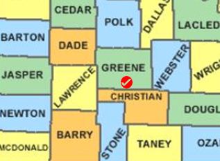
Image:MOGreene.JPG | Image:MOGreene.JPG | ||
poly 273 60 315 59 315 133 272 130 [[Wright County, Missouri Genealogy|Wright County]] | poly 273 60 315 59 315 133 272 130 [[Wright County, Missouri Genealogy|Wright County]] | ||
poly 139 145 175 145 175 178 181 178 182 232 143 232 144 179 138 177 [[Stone County, Missouri Genealogy|Stone County]] | poly 139 145 175 145 175 178 181 178 182 232 143 232 144 179 138 177 [[Stone County, Missouri Genealogy|Stone County]] | ||
| Line 24: | Line 24: | ||
desc none | desc none | ||
</imagemap> | </imagemap> | ||
<noinclude> | <noinclude> | ||
__NORICHEDITOR__ | __NORICHEDITOR__ | ||
[[Category:Image_map_templates]]</noinclude> | [[Category:Image_map_templates]]</noinclude> | ||
Revision as of 13:12, 24 February 2015
__NORICHEDITOR__