Template:ARCarroll County, Arkansas Clickable Neighbors: Difference between revisions
m (Text replacement - "desc none desc none" to "desc none") |
m (Text replace - "County, Arkansas|" to "County, Arkansas Genealogy|") |
||
| (7 intermediate revisions by 3 users not shown) | |||
| Line 10: | Line 10: | ||
poly 297 76 300 77 300 145 296 148 [[Marion County, Arkansas Genealogy|Marion County]] | poly 297 76 300 77 300 145 296 148 [[Marion County, Arkansas Genealogy|Marion County]] | ||
poly 290 155 300 156 299 220 294 220 [[Searcy County, Arkansas Genealogy|Searcy County]] | poly 290 155 300 156 299 220 294 220 [[Searcy County, Arkansas Genealogy|Searcy County]] | ||
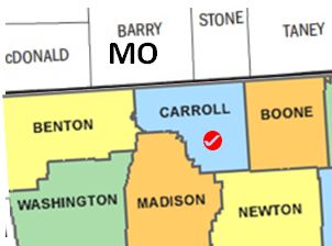
poly 298 59 296 17 231 14 231 58 [[Taney County, Missouri | poly 298 59 296 17 231 14 231 58 [[Taney County, Missouri|Taney County]] | ||
poly 180 68 222 65 220 10 178 9 [[Stone County, Missouri | poly 180 68 222 65 220 10 178 9 [[Stone County, Missouri|Stone County]] | ||
poly 87 74 170 69 166 13 86 11 [[Barry County, Missouri | poly 87 74 170 69 166 13 86 11 [[Barry County, Missouri|Barry County]] | ||
poly 8 79 80 76 77 24 7 25 [[McDonald County, Missouri | poly 8 79 80 76 77 24 7 25 [[McDonald County, Missouri|McDonald County]] | ||
poly 77 16 76 10 9 9 8 17 [[Newton County, Missouri | poly 77 16 76 10 9 9 8 17 [[Newton County, Missouri|Newton County]] | ||
poly 8 183 6 183 5 219 15 220 [[Adair County, Oklahoma|Adair County]] | poly 8 183 6 183 5 219 15 220 [[Adair County, Oklahoma|Adair County]] | ||
desc none | desc none | ||
</imagemap> | </imagemap> | ||
| Line 22: | Line 22: | ||
__NORICHEDITOR__ | __NORICHEDITOR__ | ||
[[Category:Image_map_templates]] | [[Category:Image_map_templates]] | ||
Revision as of 13:37, 5 February 2015
__NORICHEDITOR__