Template:MONew Madrid, Missouri Clickable Neighbors: Difference between revisions
m (Added map attributes; removed blank lines) |
m (Text replace - "County, Arkansas|" to "County, Arkansas Genealogy|") |
||
| (3 intermediate revisions by 2 users not shown) | |||
| Line 1: | Line 1: | ||
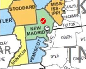
<imagemap> | <imagemap> | ||
Image:MONew_Madrid.JPG | Image:MONew_Madrid.JPG | ||
poly 92 140 124 134 128 121 142 129 153 129 158 137 150 144 163 156 159 162 137 163 156 180 155 190 145 198 139 214 101 218 [[Pemiscot County, Missouri | poly 92 140 124 134 128 121 142 129 153 129 158 137 150 144 163 156 159 162 137 163 156 180 155 190 145 198 139 214 101 218 [[Pemiscot County, Missouri|Pemiscot County]] | ||
poly 53 93 84 90 98 220 27 229 73 161 72 139 60 131 57 117 46 117 [[Dunklin County, Missouri | poly 53 93 84 90 98 220 27 229 73 161 72 139 60 131 57 117 46 117 [[Dunklin County, Missouri|Dunklin County]] | ||
poly 126 34 152 28 189 69 182 81 178 109 166 112 173 94 154 88 149 93 161 109 160 118 165 131 165 137 160 140 150 128 133 127 124 123 126 130 90 138 84 87 130 81 [[New Madrid County, Missouri | poly 126 34 152 28 189 69 182 81 178 109 166 112 173 94 154 88 149 93 161 109 160 118 165 131 165 137 160 140 150 128 133 127 124 123 126 130 90 138 84 87 130 81 [[New Madrid County, Missouri|New Madrid County]] | ||
poly 0 121 43 116 53 82 26 27 2 33 [[Butler County, Missouri | poly 0 121 43 116 53 82 26 27 2 33 [[Butler County, Missouri|Butler County]] | ||
poly 43 0 27 28 0 30 4 0 [[Wayne County, Missouri | poly 43 0 27 28 0 30 4 0 [[Wayne County, Missouri|Wayne County]] | ||
poly 123 22 128 81 55 87 53 74 29 34 46 3 112 1 [[Stoddard County, Missouri | poly 123 22 128 81 55 87 53 74 29 34 46 3 112 1 [[Stoddard County, Missouri|Stoddard County]] | ||
poly 113 2 126 18 126 31 151 29 177 0 [[Scott County, Missouri | poly 113 2 126 18 126 31 151 29 177 0 [[Scott County, Missouri|Scott County]] | ||
poly 153 31 184 3 221 0 219 20 213 26 213 33 224 40 224 44 210 45 217 62 208 85 [[Mississippi County, Missouri | poly 153 31 184 3 221 0 219 20 213 26 213 33 224 40 224 44 210 45 217 62 208 85 [[Mississippi County, Missouri|Mississippi County]] | ||
poly 49 118 55 132 68 139 71 161 63 165 53 181 32 180 29 170 1 171 0 124 [[Clay County, Arkansas Genealogy|Clay County]] | poly 49 118 55 132 68 139 71 161 63 165 53 181 32 180 29 170 1 171 0 124 [[Clay County, Arkansas Genealogy|Clay County]] | ||
poly 44 230 139 217 153 233 150 236 133 236 43 238 [[Mississippi County, Arkansas Genealogy|Mississippi County]] | poly 44 230 139 217 153 233 150 236 133 236 43 238 [[Mississippi County, Arkansas Genealogy|Mississippi County]] | ||
| Line 17: | Line 17: | ||
poly 209 235 219 231 220 226 233 208 244 217 244 232 272 238 208 239 [[Crockett County, Tennessee|Crockett County]] | poly 209 235 219 231 220 226 233 208 244 217 244 232 272 238 208 239 [[Crockett County, Tennessee|Crockett County]] | ||
poly 234 161 267 154 283 173 297 173 296 239 296 234 273 239 285 238 275 237 267 234 251 233 243 218 232 204 238 200 [[Gibson County, Tennessee|Gibson County]] | poly 234 161 267 154 283 173 297 173 296 239 296 234 273 239 285 238 275 237 267 234 251 233 243 218 232 204 238 200 [[Gibson County, Tennessee|Gibson County]] | ||
poly 184 98 185 88 184 80 189 75 198 80 206 88 214 87 217 74 220 65 243 75 260 72 266 77 278 85 278 88 [[Fulton County, Kentucky | poly 184 98 185 88 184 80 189 75 198 80 206 88 214 87 217 74 220 65 243 75 260 72 266 77 278 85 278 88 [[Fulton County, Kentucky|Fulton County]] | ||
poly 283 88 274 32 235 35 231 33 222 33 226 44 217 47 216 51 218 63 262 73 [[Hickman County, Kentucky | poly 283 88 274 32 235 35 231 33 222 33 226 44 217 47 216 51 218 63 262 73 [[Hickman County, Kentucky|Hickman County]] | ||
poly 155 237 156 231 177 227 182 224 195 221 209 234 210 239 [[Lauderdale County, Tennessee|Lauderdale County]] | poly 155 237 156 231 177 227 182 224 195 221 209 234 210 239 [[Lauderdale County, Tennessee|Lauderdale County]] | ||
poly 154 229 181 229 177 222 192 221 212 235 222 226 228 208 227 202 236 198 232 161 175 164 178 168 154 172 163 180 155 189 146 197 141 220 [[Dyer County, Tennessee|Dyer County]] | poly 154 229 181 229 177 222 192 221 212 235 222 226 228 208 227 202 236 198 232 161 175 164 178 168 154 172 163 180 155 189 146 197 141 220 [[Dyer County, Tennessee|Dyer County]] | ||
poly 215 33 234 33 235 38 274 33 272 0 254 0 243 2 232 2 [[Carlisle County, Kentucky | poly 215 33 234 33 235 38 274 33 272 0 254 0 243 2 232 2 [[Carlisle County, Kentucky|Carlisle County]] | ||
poly 273 1 283 89 296 86 298 0 [[Graves County, Kentucky | poly 273 1 283 89 296 86 298 0 [[Graves County, Kentucky|Graves County]] | ||
desc none | desc none | ||
</imagemap> | </imagemap> | ||
<noinclude> | <noinclude> | ||
__NORICHEDITOR__ | __NORICHEDITOR__ | ||
[[Category:Image_map_templates]] | [[Category:Image_map_templates]] | ||
Revision as of 13:37, 5 February 2015
__NORICHEDITOR__