Template:MOCass, Missouri Clickable Neighbors: Difference between revisions
No edit summary |
Jabecenti80 (talk | contribs) No edit summary |
||
| (6 intermediate revisions by 4 users not shown) | |||
| Line 1: | Line 1: | ||
<imagemap> | <imagemap> | ||
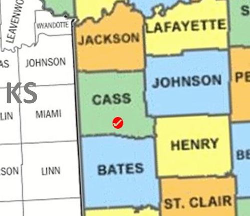
Image:MOCass1.JPG | Image:MOCass1.JPG | ||
poly 153 139 287 137 289 223 305 233 306 271 163 266 [[Cass County, Missouri | poly 153 139 287 137 289 223 305 233 306 271 163 266 [[Cass County, Missouri|Cass County]] | ||
poly 160 272 241 272 269 277 308 273 316 417 297 410 167 416 [[Bates County, Missouri | poly 160 272 241 272 269 277 308 273 316 417 297 410 167 416 [[Bates County, Missouri|Bates County]] | ||
poly 169 429 169 417 267 411 273 421 295 410 316 421 318 428 [[Vernon County, Missouri | poly 169 429 169 417 267 411 273 421 295 410 316 421 318 428 [[Vernon County, Missouri|Vernon County]] | ||
poly 320 430 319 355 469 352 469 428 [[St. Clair County, Missouri | poly 320 430 319 355 469 352 469 428 [[St. Clair County, Missouri|St. Clair County]] | ||
poly 473 428 470 396 497 394 497 428 [[Hickory County, Missouri | poly 473 428 470 396 497 394 497 428 [[Hickory County, Missouri|Hickory County]] | ||
poly 459 243 497 241 497 392 471 391 470 353 466 345 [[Benton County, Missouri | poly 459 243 497 241 497 392 471 391 470 353 466 345 [[Benton County, Missouri|Benton County]] | ||
poly 310 233 455 228 459 343 314 351 [[Henry County, Missouri | poly 310 233 455 228 459 343 314 351 [[Henry County, Missouri|Henry County]] | ||
poly 290 105 360 109 362 98 435 95 439 99 449 97 450 2 402 0 399 3 365 6 360 2 342 15 333 16 330 28 316 27 320 12 308 15 309 29 288 39 [[Lafayette County, Missouri | poly 290 105 360 109 362 98 435 95 439 99 449 97 450 2 402 0 399 3 365 6 360 2 342 15 333 16 330 28 316 27 320 12 308 15 309 29 288 39 [[Lafayette County, Missouri|Lafayette County]] | ||
poly 253 8 263 5 264 13 289 32 304 29 300 15 321 6 327 13 324 24 332 13 336 16 357 0 257 1 [[Ray County, Missouri | poly 253 8 263 5 264 13 289 32 304 29 300 15 321 6 327 13 324 24 332 13 336 16 357 0 257 1 [[Ray County, Missouri|Ray County]] | ||
poly 146 32 145 0 87 1 88 14 98 16 106 27 120 29 134 23 [[Platte County, Missouri | poly 146 32 145 0 87 1 88 14 98 16 106 27 120 29 134 23 [[Platte County, Missouri|Platte County]] | ||
poly 284 34 287 137 154 136 147 50 175 36 190 46 205 34 207 21 216 30 233 4 245 2 254 11 260 8 262 21 [[Jackson County, Missouri | poly 284 34 287 137 154 136 147 50 175 36 190 46 205 34 207 21 216 30 233 4 245 2 254 11 260 8 262 21 [[Jackson County, Missouri|Jackson County]] | ||
poly 237 0 228 4 218 26 208 16 205 15 205 34 191 39 184 35 150 47 157 39 152 32 150 33 149 0 [[Clay County, Missouri | poly 237 0 228 4 218 26 208 16 205 15 205 34 191 39 184 35 150 47 157 39 152 32 150 33 149 0 [[Clay County, Missouri|Clay County]] | ||
poly 142 68 147 169 40 170 36 97 39 95 40 87 59 94 71 90 79 68 98 72 [[Johnson County, Kansas | poly 142 68 147 169 40 170 36 97 39 95 40 87 59 94 71 90 79 68 98 72 [[Johnson County, Kansas|Johnson County]] | ||
poly 454 98 459 227 294 227 290 108 366 110 366 104 435 101 [[Johnson County, Missouri | poly 454 98 459 227 294 227 290 108 366 110 366 104 435 101 [[Johnson County, Missouri|Johnson County]] | ||
poly 458 242 496 240 497 95 459 94 [[Pettis County, Missouri | poly 458 242 496 240 497 95 459 94 [[Pettis County, Missouri|Pettis County]] | ||
poly 141 68 142 41 145 40 134 36 128 32 105 32 98 20 71 20 69 86 74 78 76 65 84 64 94 69 [[Wyandotte County, Kansas | poly 141 68 142 41 145 40 134 36 128 32 105 32 98 20 71 20 69 86 74 78 76 65 84 64 94 69 [[Wyandotte County, Kansas|Wyandotte County]] | ||
poly 0 174 37 173 36 94 28 100 9 95 6 100 0 101 [[Douglas County, Kansas | poly 0 174 37 173 36 94 28 100 9 95 6 100 0 101 [[Douglas County, Kansas|Douglas County]] | ||
poly 68 85 68 20 86 19 82 12 83 8 77 0 0 0 3 97 9 95 17 99 23 99 27 102 28 94 38 93 43 86 56 89 [[Leavenworth County, Kansas | poly 68 85 68 20 86 19 82 12 83 8 77 0 0 0 3 97 9 95 17 99 23 99 27 102 28 94 38 93 43 86 56 89 [[Leavenworth County, Kansas|Leavenworth County]] | ||
poly 37 171 41 285 0 287 -1 175 [[Franklin County, Kansas | poly 37 171 41 285 0 287 -1 175 [[Franklin County, Kansas|Franklin County]] | ||
poly 0 401 1 289 41 285 44 399 [[Anderson County, Kansas | poly 0 401 1 289 41 285 44 399 [[Anderson County, Kansas|Anderson County]] | ||
poly 44 428 45 400 -1 401 0 426 [[Allen County, Kansas | poly 44 428 45 400 -1 401 0 426 [[Allen County, Kansas|Allen County]] | ||
poly 43 286 153 280 159 394 45 401 [[Linn County, Kansas | poly 43 286 153 280 159 394 45 401 [[Linn County, Kansas|Linn County]] | ||
poly 46 400 159 394 159 427 47 428 [[Bourbon County, Kansas | poly 46 400 159 394 159 427 47 428 [[Bourbon County, Kansas|Bourbon County]] | ||
poly 42 284 39 174 147 168 153 279 [[Miami County, Kansas | poly 42 284 39 174 147 168 153 279 [[Miami County, Kansas|Miami County]] | ||
desc none</imagemap> | desc none | ||
</imagemap> | |||
<noinclude> | <noinclude> | ||
__NORICHEDITOR__ | __NORICHEDITOR__ | ||
[[Category:Image_map_templates]] | |||
[[Category:Image_map_templates]] | |||
Revision as of 07:30, 15 March 2014
__NORICHEDITOR__