File:VietnameseProvincesMap.png
Size of this preview: 360 × 600 pixels. Other resolution: 428 × 713 pixels.
Original file (428 × 713 pixels, file size: 29 KB, MIME type: image/png)
Summary[edit | edit source]
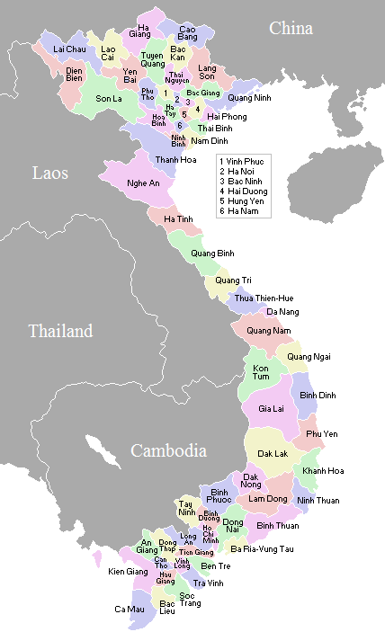
| Description |
A map showing the borders and names of the Vietnamese provinces (including the changes approved in Nov 2003), updated 17 Mar 2005. |
|---|---|
| Author |
Waerth, a Wikimedia Commons user |
| Source |
Waerth, File:VietnameseProvincesMap.png, Wikimedia Commons, accessed 20 April 2016. |
| Date |
2 November 2007 |
| Permission |
See below. |
Licensing[edit | edit source]
|
|
This work has been released into the public domain by the copyright holder. This applies worldwide. In case this is not legally possible: The copyright holder grants any entity the right to use this work for any purpose, without any conditions, unless such conditions are required by law. |
File history
Click on a date/time to view the file as it appeared at that time.
| Date/Time | Thumbnail | Dimensions | User | Comment | |
|---|---|---|---|---|---|
| current | ★ Approved revision 09:30, 20 April 2016 | | 428 × 713 (29 KB) | Murphynw (talk | contribs) | {{Information | Description = A map showing the borders and names of the Vietnamese provinces (including the changes approved in Nov 2003), updated 17 Mar 2005. | Source = Waerth, [https://en.wikipedia.org/wiki/File:VietnameseProvincesMap.png File:Viet... |
You cannot overwrite this file.
File usage
The following 2 pages use this file: