File:Rif Dimashq districts.PNG
Size of this preview: 800 × 593 pixels. Other resolution: 900 × 667 pixels.
Original file (900 × 667 pixels, file size: 117 KB, MIME type: image/png)
Summary[edit | edit source]
| Description |
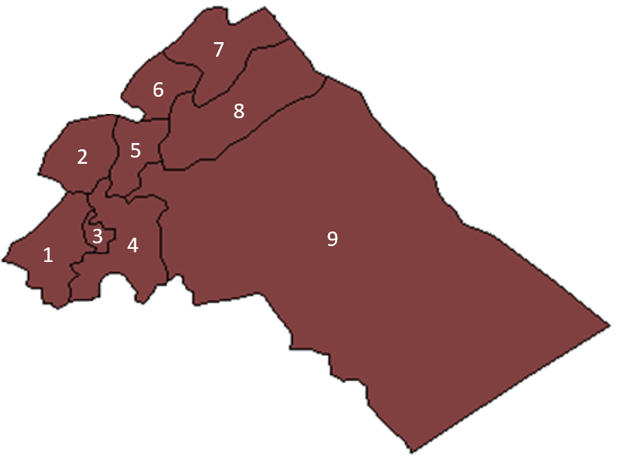
Blank map of Rif Dimashq's districts, as they were up to 2009, when a tenth district, Qudsaya District, was created out of parts of Markaz Rif Dimashq and Zabadani districts. |
|---|---|
| Author | |
| Source |
https://en.wikipedia.org/wiki/File:Rif_Dimashq_blank_districts.png |
| Date |
9 May 2007 |
| Permission |
See license tag below. |
Licensing[edit | edit source]
| This file is licensed under the Creative CommonsAttribution-Share Alike 3.0 Unported license. | ||
|
File history
Click on a date/time to view the file as it appeared at that time.
| Date/Time | Thumbnail | Dimensions | User | Comment | |
|---|---|---|---|---|---|
| current | ★ Approved revision 15:57, 10 February 2021 | | 900 × 667 (117 KB) | Amberannelarsen (talk | contribs) | {{Information | Description = Blank map of Rif Dimashq's districts, as they were up to 2009, when a tenth district, Qudsaya District, was created out of parts of Markaz Rif Dimashq and Zabadani districts. | Source = https://en.wikipedia.org/wiki/File:Rif_Dimashq_blank_districts.png | Date = 9 May 2007 | Author = [https://en.wikipedia.org/wiki/User:Anas_Salloum Anas] | Permission = }} Category:Syria |
You cannot overwrite this file.
File usage
The following 10 pages use this file:
- Al Nabaq, Rif Dimashq Governorate, Syria Genealogy
- Al Qutayfah, Rif Dimashq Governorate, Syria Genealogy
- Al Tal, Rif Dimashq Governorate, Syria Genealogy
- Al Zabadani, Rif Dimashq Governorate, Syria Genealogy
- Daraya, Rif Dimashq Governorate, Syria Genealogy
- Duma, Rif Dimashq Governorate, Syria Genealogy
- Qatana, Rif Dimashq Governorate, Syria Genealogy
- Qudsiya, Rif Dimashq Governorate, Syria Genealogy
- Rural Damascus, Rif Dimashq Governorate, Syria Genealogy
- Yabrud, Rif Dimashq Governorate, Syria Genealogy