File:Penang location map.PNG

Size of this preview: 483 × 599 pixels. Other resolution: 562 × 697 pixels.
Original file (562 × 697 pixels, file size: 114 KB, MIME type: image/png)
Summary[edit | edit source]
| Description |
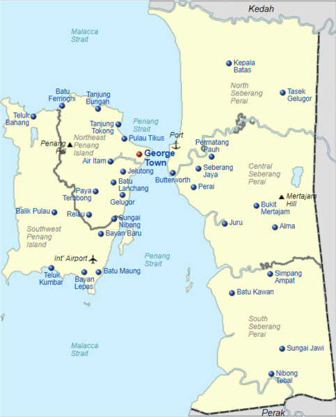
English: Location map of Penang
Bahasa Melayu: Peta lokasi Pulau Pinang |
|---|---|
| Author |
Original map by Dreamtrooper, current map border drawn by Vnonymous, vectorised to Scalable Vector Graphics (SVG) by Molecule Extraction (see original file location) |
| Source | |
| Date |
20 December 2017 |
| Permission |
See license tag below. |
Licensing[edit | edit source]
| This file is licensed under the Creative CommonsAttribution-Share Alike 3.0 Unported license. | ||
|
File history
Click on a date/time to view the file as it appeared at that time.
| Date/Time | Thumbnail | Dimensions | User | Comment | |
|---|---|---|---|---|---|
| current | ★ Approved revision 13:49, 13 January 2021 | | 562 × 697 (114 KB) | Amberannelarsen (talk | contribs) | {{Information |Description = '''English:''' Location map of Penang<br> Geographic limits of the map:<br> *N: 5.5859° N *S: 5.1224° N *W: 100.1720° E *E: 100.5510° E<br> '''Bahasa Melayu:''' Peta lokasi Pulau Pinang |Source = https://en.wikipedia.org/wiki/File:Penang_location_map.svg |Date = 20 December 2017 |Author = Original map by Dreamtrooper, current map border drawn by Vnonymous, vectorised to Scalable Vector Graphics (SVG) by Molecule Extraction (see original file location) |Permission... |
You cannot overwrite this file.
File usage
The following page uses this file: