File:KY MONROE.PNG
No higher resolution available.
KY_MONROE.PNG (252 × 212 pixels, file size: 37 KB, MIME type: image/png)
Summary[edit | edit source]
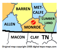
Map courtesy of Digital-Topo-Maps.com. Copyright 2005.
Licensing[edit | edit source]
 |
This is a logo of an organization and is protected by copyright. Uploading of the logo should only be done by the organization owning the logo. Certain commercial use of this image may also be trademark infringement. Use of this logo can only be used on the FamilySearch Research Wiki by permission of the organization. This work is not subject to any Creative Commons license. |
File history
Click on a date/time to view the file as it appeared at that time.
| Date/Time | Thumbnail | Dimensions | User | Comment | |
|---|---|---|---|---|---|
| current | ★ Approved revision 17:59, 7 June 2018 | | 252 × 212 (37 KB) | Dotxinxoz (talk | contribs) | Map courtesy of [https://www.digital-topo-maps.com/county-map/kentucky.shtml Digital-Topo-Maps.com]. Copyright 2005.<br> Category:Kentucky Maps Category:Monroe County, Kentucky |
You cannot overwrite this file.
File usage
The following 2 pages use this file: