File:Israel map.png
Size of this preview: 450 × 600 pixels. Other resolution: 1,728 × 2,304 pixels.
Original file (1,728 × 2,304 pixels, file size: 2.83 MB, MIME type: image/png)
Summary[edit | edit source]
| Description |
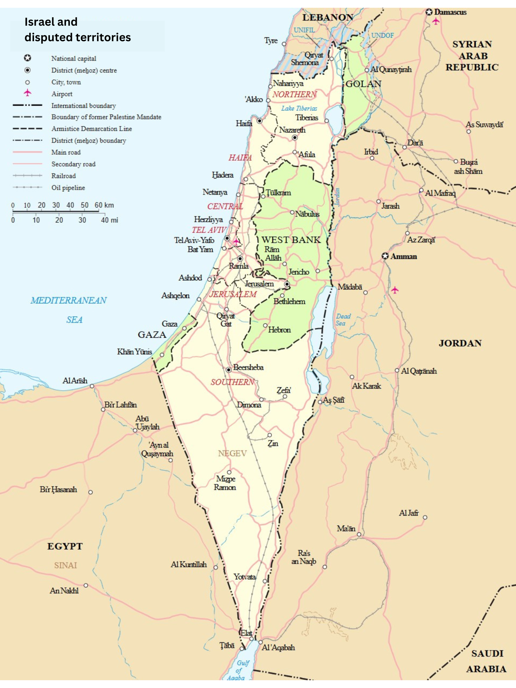
Map of Israel (edited). Original:https://commons.wikimedia.org/wiki/File:Map_of_Israel,_neighbours_and_occupied_territories.svg |
|---|---|
| Author |
un.org |
| Source |
Wikimedia Commons |
| Date |
November 19, 2024 |
| Permission |
See Licensing below |
Licensing[edit | edit source]
|
|
This work has been identified as being free of known restrictions under copyright law, including all related and neighboring rights. You can copy, modify, distribute and perform the work, even for commercial purposes, all without asking permission. See Other Information for details. |
File history
Click on a date/time to view the file as it appeared at that time.
| Date/Time | Thumbnail | Dimensions | User | Comment | |
|---|---|---|---|---|---|
| current | ★ Approved revision 16:12, 19 November 2024 | | 1,728 × 2,304 (2.83 MB) | Lldaly12 (talk | contribs) | {{Information | Description = Map of Israel (edited). Original:https://commons.wikimedia.org/wiki/File:Map_of_Israel,_neighbours_and_occupied_territories.svg | Source = Wikimedia Commons | Date = November 19, 2024 | Author = un.org | Permission = See Licensing below }} Category:ADD CATEGORY HERE |
You cannot overwrite this file.
File usage
The following page uses this file: