File:COWELD.JPG

Size of this preview: 614 × 599 pixels. Other resolution: 617 × 602 pixels.
Original file (617 × 602 pixels, file size: 44 KB, MIME type: image/jpeg)
Summary[edit | edit source]
Map courtesy of Digital-Topo-Maps.com. Copyright 2005.
Licensing[edit | edit source]
 |
This image is under copyright by the owner, Digital-Topo-Maps and is used by permission under the condition that the copyright is listed and attribution is given. This work is not subject to any Creative Commons license. |
File history
Click on a date/time to view the file as it appeared at that time.
| Date/Time | Thumbnail | Dimensions | User | Comment | |
|---|---|---|---|---|---|
| current | ★ Approved revision 11:18, 19 October 2017 | | 617 × 602 (44 KB) | Amberannelarsen (talk | contribs) | |
| 08:52, 17 October 2017 |  | 610 × 601 (44 KB) | Amberannelarsen (talk | contribs) | Category:Colorado Maps Category:Weld County, Colorado | |
| 09:38, 12 October 2017 |  | 549 × 510 (38 KB) | Amberannelarsen (talk | contribs) | Category:Colorado Maps Category:Weld County, Colorado | |
| 10:16, 15 July 2014 | 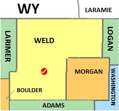 | 410 × 384 (29 KB) | Wyzer17 (talk | contribs) | Category:Weld County, Colorado Category:Colorado_Maps |
You cannot overwrite this file.
File usage
The following 2 pages use this file: